|
TOWN CENTER |
|
|
|
|
|
TOWN CENTER |
|
|
|
|
|
|
|
|
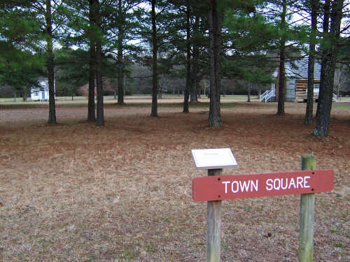
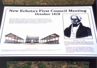
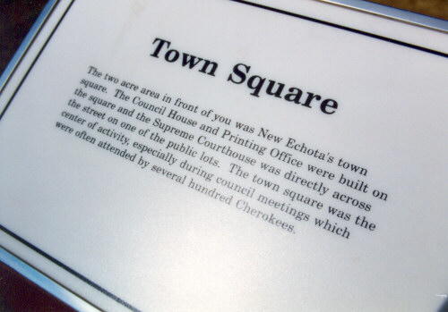
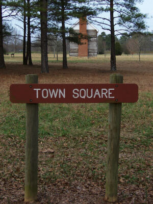
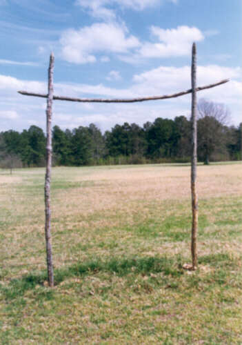
"New Echota fell into ruin in the years following the Trail of Tears. All of the buildings, except the Worcester House, were destroyed. Even the trees that once shaded the town were cut and the area was cleared for farming. Use your Imagination and picture what it would have been like to stand on this spot in 1830. Around you stood a town consisting of about ten dwelling houses, four stores, three government buildings, and twenty-five outbuildings such as corn cribs and stables. About fifty people lived here, but during council meetings several hundred Cherokees filled the town. The town square and public buildings in front of you formed the town center around which New Echota's residents lived. Georgia Highway 225 today blocks the view north to the Oostanaula River, which formed the northern limits of New Echota." So reads the SGT brochure/map regarding our second stop. There is not too much to photograph in this particular spot except informational signs. One such sign tells us about the first council meeting here: |
|
"From 1788-1816 the Cherokee Council met at Oostanauleh located about four miles east of here. In 1819 a new council house was constructed at New Town and the seat of the Cherokee government moved here. In 1825 the council selected New Town as the permanent capital of the Cherokee Nation and the name was changed to New Echota in memory of the old, beloved town of Chota." |
|
| New Echota’s First Council House |
|
|
|
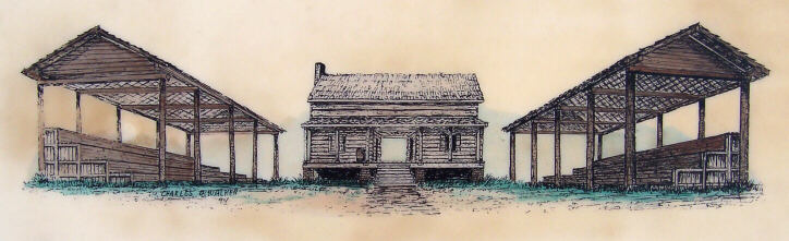
"The 1819 council house consisted of two open shelters facing each other with a log house at one end. Its exact location has never been determined but it probably stood near the center of town. In 1822 the Council authorized the construction of a new council house to replace it." |
 |
|
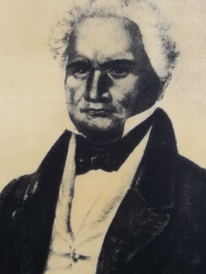
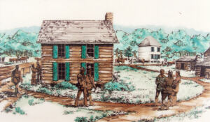
The same sign introduces us to Major Ridge, who will figure significantly into the legacy of New Echota later (which you already know if you visited the museum with me). "Major Ridge was a prominent Cherokee leader during the early 1800's. He was a frequent visitor to New Echota and in October 1819, he led the procession of Cherokee officials into the Council House for the first session. Rev. Abraham Steiner was there that day and described what took place: 'It was past noon, the council had convened and a multitude of people gathered. All at once a troop of horsemen were seen coming along the road . . . with a stately looking person in front. A little way from the council they alighted, marched two in a file toward the council house with the stately person before them, whom I observed on drawing near to be the Ridge . . . who is reported to be the greatest orator in the nation.'" |
Major Ridge (c. 1771 - 1839) |
|
|
|
|
|
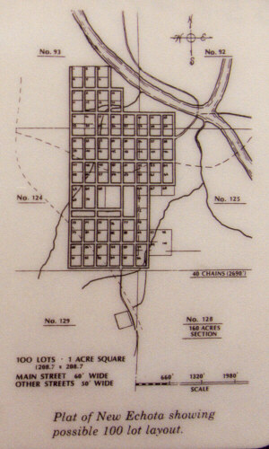
"You are now standing near the center of the former Cherokee capital. New Echota was a planned community, divided into a series of lots and streets. The Cherokee government buildings; the Council House, Supreme Courthouse, and printing office dominated the center of town, with several private homes, stores, a ferry, and a mission station in the surrounding area. To your left, Highway 225 blocks the view north to the Oostanaula River which formed the northern limits of New Echota. Benjamin Gold stood near here in 1829 and described what he saw: |
|
|
|
'This neighborhood is truly an interesting and pleasant place; the ground is as level and smooth as a house floor; the center of the nation - a new place, laid out in city form. Six new frame houses in sight besides the Council House, Courthouse, printing office, and four stores, all in sight of Mr. Boudinot’s house.'" |
 |
|
|
|
|
|
|||||||||||||||
|
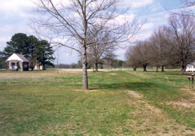
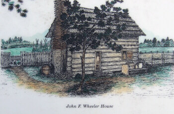
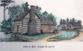
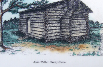
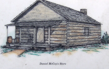
"A Town That Disappeared – What you don’t see – By the late 1800's the town of New Echota had ceased to exist. All of the buildings, except for the Worcester House, had been destroyed. Even the trees that once shaded the town had been cut and the area cleared for farming. The historic buildings you tour today represent only a small part of what was once the town of New Echota. Many other buildings were once located in New Echota including the four depicted here. The exact sites where these four buildings once stood have not yet been determined." |
|
|
|
|
|
 |
|
 |
|
|
|
|
|
|
|
|
|
|